Personnel Profiles
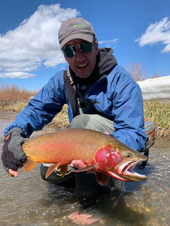
Ryan Colyer
Principal, Fluvial Morphologist / Fisheries Biologist
Mr. Colyer is the principal at Biota. Mr. Colyer graduated from the University of Washington with a B.S. in Biology, specializing in ecology, conservation, and evolution. Mr. Colyer subsequently completed the Post-baccalaureate Certificate Program in Geographic Information Systems at Pennsylvania State University, completed river restoration and sediment transport course program at Utah State University, and completed the fluvial geomorphology level IV certification program through Wildland Hydrology. Mr. Colyer is currently a certified Technical Service Provider with the Natural Resources Conservation Service, and he has extensive experience designing, implementing, and managing geomorphic assessment and riverine restoration projects, fishery assessments, hydrologic and hydraulic investigations, and ecological enhancements projects. Mr. Colyer has used and trained others in the use of the PIBO riparian habitat monitoring protocol, Rosgen stream type classification, Pfankuch stream reach stability system, bankful identification, riparian vegetation community type mapping, bank stability analysis, macro-invertebrate sampling, periphyton sampling, transit and total station survey techniques, electro-fishing and snorkel surveying techniques, and the sedation and identification of various salmonid species. Mr. Colyer has worked in the fisheries field throughout the Northwest, including Washington, Idaho, Montana, Utah, Nevada, and Oregon. He has worked for government agencies, educational institutions, non-profit organizations, and the private sector.
Kent Werlin
Senior Wetland Scientist / Restoration Ecologist
Mr. Werlin holds a bachelor’s degree from the University of Colorado in Environmental Studies and a M.S. degree from South Dakota State University in Wildlife and Fisheries Sciences with a specialization in wetland and aquatic ecology. He has 15 years of experience conducting research, restoration, and rehabilitation of wetland/riparian ecosystems in the western United States. Mr. Werlin gained valuable experience as a research assistant for an EPA-funded project in North Dakota, where he assisted with the development of regional bioindicator criteria for the functional assessment of floodplain wetlands. Additionally, Mr. Werlin worked for the Nez Perce Tribe as a fisheries habitat biologist and project manager for 5 years, where he focused on stream, wetland, and watershed restoration and protection to aid in the recovery of salmonids in the Clearwater River basin of northern Idaho. He is an active member of the Society of Ecological Restoration and Ecological Society of America and is a certified Professional Wetland Scientist through the Society of Wetland Scientists. Additionally, Mr. Werlin has been certified as a Technical Service Provider for NRCS, and he has received advanced training in jurisdictional wetland delineation, wetland creation and restoration, revegetation design, bioengineering, hydric soils, fluvial geomorphology, NEPA/ESA compliance, and aquatic ecosystem monitoring/assessment. As the Senior Wetland Scientist/Restoration Ecologist for Biota, Mr. Werlin conducts wetland delineations, ecological assessments, federal and local permitting, ESA-listed plant surveys, native plant community restoration, reclamation, compensatory mitigation, riparian/wetland restoration, and habitat enhancement.
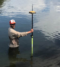
Chad Bailey, PE, CFM
Professional Engineer
Mr. Bailey specializes in restoration design, channel and floodplain design, hydraulic and hydrologic modeling, water resource engineering, reclamation and civil engineering, bank stability, and remediation. He has more than 16 years of professional experience in restoration engineering, water resources, reclamation, and construction oversight. Professional capabilities include 1-dimensional and 2-dimensional steady state and non-steady state hydraulic modeling, flood frequency analysis, floodplain mapping, technical plan and specification development, generation of cost estimates, and project oversight and management. Mr. Bailey’s experience includes design of stream and river channels, design of fish passage structures and barriers, fish habitat restoration, stream diversion structures, bank reconstruction, sedimentation ponds, hydraulic structures including outlet works and fish passable diversions, flood frequency analysis, rainfall-runoff modeling, dam breach analysis, and reservoir routing. Mr. Bailey has functioned as a lead hydraulic researcher on stream stability and bank erosion studies in the United States, Canada, and Australia.
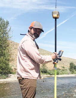
Jeff Phillips
Fluvial Geomorphologist
Mr. Phillips has a bachelor’s degree from the University of Utah in Geography, with a focus on earth science, and a M.S. degree in Fluvial Geomorphology from the University of British Columbia. Jeff also has a Professional Certificate in Geographic Information Systems (GIS) from the University of Utah and has completed the Sediment Transport in Stream Assessment and Design course at Utah State University and the Columbia Habitat Monitoring Protocol (CHaMP) Field Training. He has expertise with developing river restorations designs as well as both watershed- and reach-scale geomorphic assessments that include analyses such as landslide inventories, sediment budgets, channel migration, sediment transport, flood inundation, stream channel stability, and fish habitat quantity and quality. He has on-the-ground experience in stream channel survey techniques, geomorphic surveys, fish passage assessments, slope stability evaluations, risk assessments, and the identification of high-priority reaches for fish habitat restoration and enhancement. Mr. Phillips has worked in the aquatic restoration field throughout the Northwest including Idaho, Washington, Oregon, and British Columbia. He has worked with a diverse group of clients including tribes, city, state, and federal government agencies, fisheries enhancement groups, conservation districts, and private industry.
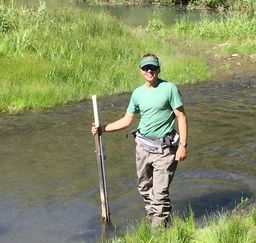
Pat Calhoun
Hydrologist / Geomorphologist
Mr. Calhoun earned a bachelor's degree in Geology at The Ohio State University and a M.S. degree from Idaho State University in Environmental Science and Management with a focus on hydrology and stream ecology. Patrick has over 10 years of experience in mapping, surveying, and collecting environmental data throughout the United States, as well as in remote locations in Argentina and Alaska. Patrick gained valuable experience working for a National Science Foundation funded research project in northwest Alaska studying the dynamic relationships between erosive landscape processes and associated impacts on water quality and ecosystem functions. Additional experience was gained through working for the US Forest Service on the Geomorphic Road Analysis and Inventory Package (GRAIP) collecting data on public land road networks and drainage patterns in Idaho, Montana, Washington, Oregon and California. Patrick's technical experience spans a wide range of environmental disciplines including hydrologic monitoring and forecasting for watercourses of all sizes; geomorphic assessment and restoration design; groundwater monitoring; geologic mapping; geomorphic channel surveying; fisheries and aquatic system enhancement; and analysis of water quality, sediment regime, and aquatic ecology. Patrick's primary responsibilities include site assessment, field data collection and analysis, and design and implementation of watershed assessment and ecological restoration projects.

Chase Krumholz
Natural Resources Specialist / GIS Technician
Mr. Krumholz is a Natural Resource Specialist and GIS Technician who specializes in field data collection and analysis, wetland delineation, GIS analysis, and report preparation for natural resource investigations. Mr. Krumholz holds Bachelor’s Degrees in Natural Resource Management and Spatial Science from Texas A&M University and has received advanced training in ESRI GIS geodatabases and data management. He has 5 years of experience conducting natural resource inventories, impact assessments and analyses, wetland delineations, rare plant surveys and community type mapping, noxious weed surveys, habitat enhancement and restoration work, post-project ecological monitoring, and GIS analysis and map production for public and private sector clients.
