Geographic Information Systems (GIS) and Mapping Services
Mapping and cartography
Sub-meter GPS accuracy
Natural resource planning
Site selection
GIS database management
Data interpretation
Spatial data analysis

Biota offers a wide range of GIS capabilities to support project-related analyses and to effectively communicate project results. Our staff has advanced education and experienced in the use of GIS software and tools and we are thus equipped to facilitate environmental planning projects with strong geographic and spatial data components.

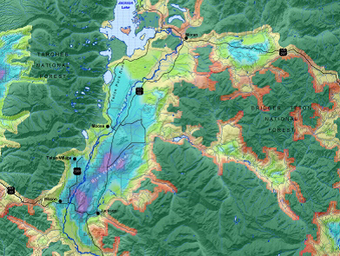
Bota’s GIS expertise begins at the project planning and management level, where we concentrate on teambuilding, disseminating information, and delegating tasks to accomplish project goals. Next, spatial data is acquired from sources such as field measurements, remote sensing, professional surveying, and data storage centers. Features associated with the acquired data are formatted and integrated into geodatabases so that modeling and analyses can be performed in a Geographic Information System. Frequently utilized analytical techniques include overlay operations, raster calculations, grid derivations, proximity assessments, queries, and geostatistics. Common applications of these GIS analyses include site selection analysis, impact assessments, wetland delineations, restoration designs, species status surveys, habitat and vegetation cover-typing, and natural resource planning. Biota uses customized mapping software to communicate project results through the creation of high quality maps, posters, brochures, map servers, and presentations.
