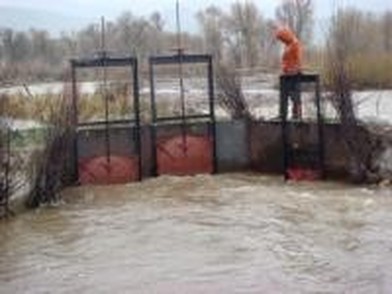
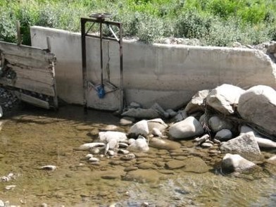
Hydrology Projects
Instream Flow Study, Muddy Creek Basin, Carbon County, Wyoming
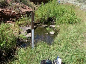
Biota was prime consultant on this completed instream flow study for the Wyoming Water Development Commission in order to quantify unappropriated direct flows in 4 study segments and determine the feasibility of satisfying specific seasonal flow rates requested by the Wyoming Game and Fish Department.
The study area was in remote southern Wyoming, and we successfully completed diverse study components associated with direct discharge measurements, installation and operation of stream flow gauging stations in all study segments, incorporation of progressive hydrologic analysis tools such as concurrent discharge measurement approach, completion of multiple hydrologic model techniques, and comprehensive quantification of unappropriated direct flows to inform Wyoming-state planning and management of surface water resources.

Groundwater Study and Hydrologic Modeling, Teton County, Wyoming
Biota was hired to design and implement a groundwater study to investigate the hydrologic support for wetlands on a private parcel north of Wilson, Wyoming. Groundwater was monitored for 7 months through installation and maintenance of a suite of piezometers, or groundwater monitoring wells. Collected data were used in conjunction with LiDAR topographic data to generate 3-dimensional surfaces representing annual groundwater levels and site topography. A digital model was constructed in order to enable a progressive and quantitative analysis of typical annual groundwater elevations relative to existing site topography for the purposes of investigating hydrologic support for observed wetlands on the parcel. Model output was used to inform the identification of 'natural' wetlands verses irrigation induced wetlands, or areas where wetland conditions exist due to the influences of human activity associated with irrigation and land use practices.
HEC-RAS Modeling — Wilson, Wyoming
Fish Creek has undergone dramatic changes in its flow regime, resulting in an over-widened, sediment- and weed-choked system. To remedy this, mid-channel islands were designed, modeled, and constructed on a reach of Fish Creek within Crescent H Ranch. The HEC-RAS computer model was used to determine pre- and post-treatment effects of several different island designs on flood potential, low flow fish habitats, and sediment transport.
The island design that was proposed and adopted by the ranch and permitted by the Corps of Engineers simultaneously increased sediment transport through the reach while not increasing the likelihood of flooding, but providing more complex low flow and spawning habitats for fish, and nesting habitat for waterfowl.
Instream Flow Study, Lower Bighorn and Nowood Basins, Bighorn County, Wyoming
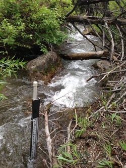
Biota completed an instream flow feasibility study for the state of Wyoming—the Wyoming Water Development Commission—in order to quantify unappropriated surface water resources in 3 study segments and to determine the feasibility of providing specific seasonal instream flows requested by the Wyoming Game and Fish Department. The project involved the establishment and operation of local stream flow gauging station, the application of regional regression equations to quantify local flow regime, and the analysis of weighted average statistical methods to precisely quantify surface water resources for state planning purposes.
Hydrologic Assessment, North and South Leigh Creek Basins, Teton Counties, Idaho and Wyoming
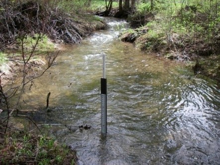
The South Leigh Creek and North Leigh Creek hydrologic study was implemented to quantify surface water resources in multiple west side Teton Mountain Range catchments.
Stream flow gauging stations were established and maintained at 20 locations from 2008 to 2010, and a subset of those gauges continue to be operated in order to achieve objectives at high priority locations. Gauging stations are located within unregulated natural watercourses, regulated streams, and all diversions. The effort has enabled precise temporal, spatial, and volumetric quantification of surface water conveyance through the multiple drainages.
Teton Creek Hydrologic Assessment, Driggs, Idaho
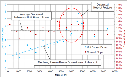
Biota was hired to complete a hydrologic analysis of Teton Creek adjacent to the town of Driggs, Idaho. Efforts focused on identifying existing hydrologic regime and fluvial instabilities stemming from past anthropogenic manipulations of the channel (e.g. dredging and straightening). Geomorphic assessment and hydraulic analyses were used to quantify channel instabilities in terms of sediment transport deficiency and hydraulic conditions. Results also identified the dispersed location of a head cut that originated from past anthropogenic alteration of the stream channel. Biota also used progressive hydrologic assessment techniques to refine previous estimates of bankfull discharge, and to quantify various peakflow rates based upon the quantified relationship of daily peak flow to mean daily discharge.
Streamflow Monitoring Program — Jackson Hole, Wyoming
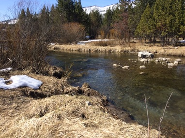
Changes in land use practices have altered flow regimes of spring creek tributaries of the Snake River in Jackson Hole. Fish Creek once received floodflows from the Snake River via several spring creeks; however, construction and maintenance of flood control levees along the Snake River have greatly altered these natural flows. Biota conducted a streamflow study to better understand interactions between the Snake River and its spring creek tributaries, and their combined effect on Fish Creek flows, and to suggest future flow augmentation magnitudes, durations, and timings necessary for restoring the ecology of spring creeks on the landward side of the complex levee system on the westbank of the Snake River in Jackson Hole.
Groundwater Monitoring and Hydrologic Study, Teton County, Wyoming
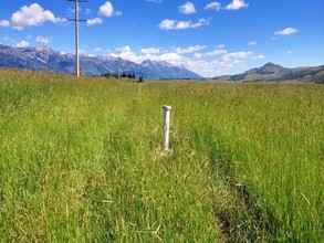
Biota was hired to design and implement a groundwater study to investigate how irrigation activities influenced wetlands in a flood-irrigated hay meadow in Teton County, WY. Biota monitored groundwater levels and subsequently worked with the US Army Corps of Engineers to determine if wetlands would revert to upland conditions in the absence of irrigation.
Fish Creek Diversion and Site Improvement Project, Gros Ventre Basin, Teton County, Wyoming
The Fish Creek Project focused on maintaining the functionality of an irrigation diversion while stabilizing a rapidly eroding stream bank in order to protect infrastructure and public lands. Fish Creek has peak flows of several thousand cubic feet per second and is a tributary to the upper Gros Ventre River. This flashy freestone system was degraded during a century of continuous anthropogenic channel manipulations (push-up dam construction, channel dredging) associated with maintaining diversion function.
Based on a morphologic stream assessment and hydrologic analysis, engineered channel stabilization treatments were designed and installed using bank toe wood protection, large woody debris roughness structures, infrastructure improvements, and bioengineering treatments inclusive of log revetments, root wad revetments, stinger and pole plantings, clump transplants, willow trenches, and bank contouring.

